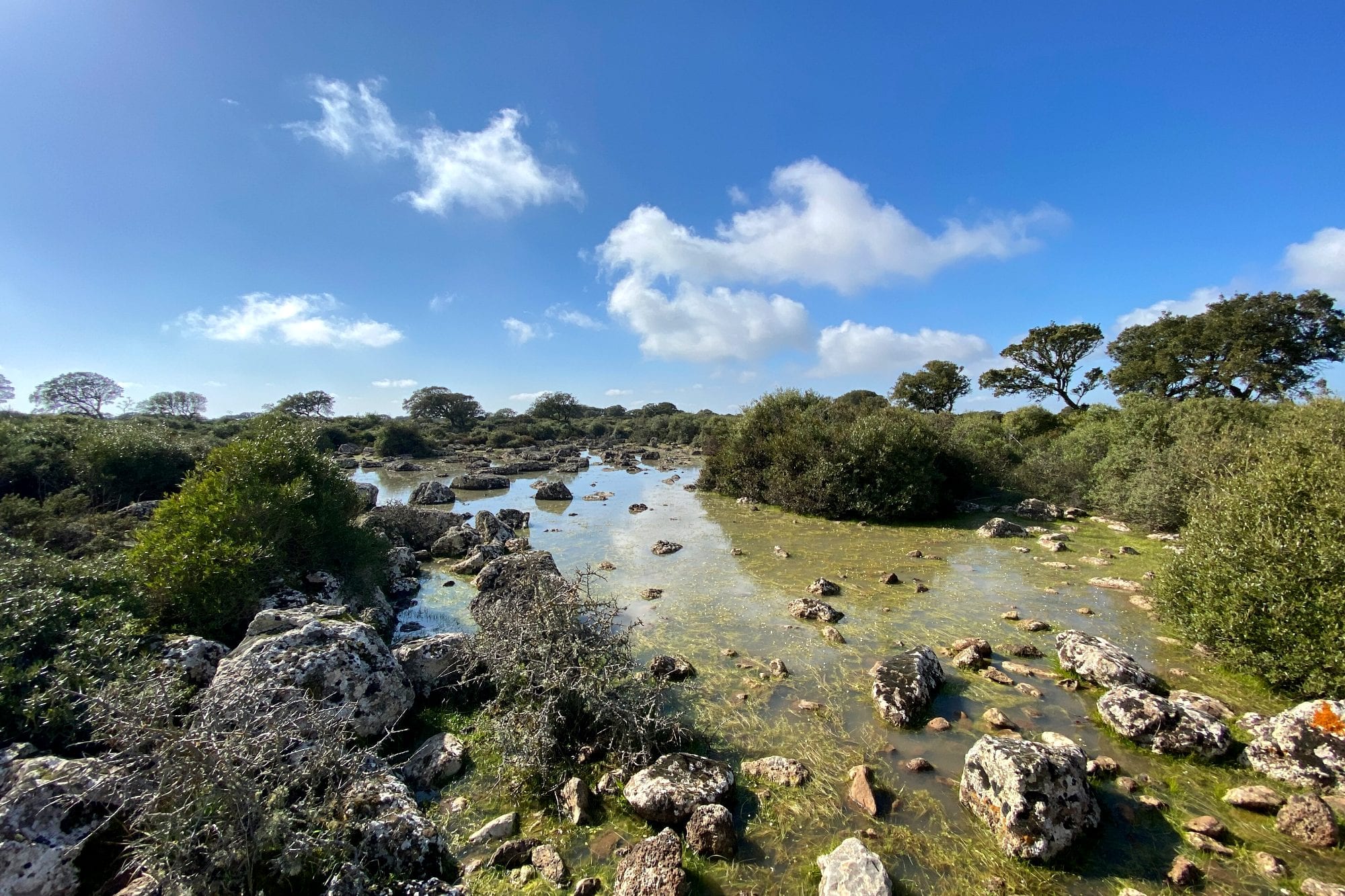
In July, on the Giara plateau of central Sardinia, the place where the lake used to be is a crust of cracked mud, as hard as a terracotta plate. No spring, no stream, no outlet: the water has gone into the air. Then the autumn rains arrive, and within a few weeks the same hollow is a sheet of water twenty-three hectares wide. Algae, mosses, tadpoles and two crustaceans that have kept the same body plan for two hundred million years all come back with it.
They are called paulis — pauli in the singular — and they are not half-finished lakes. They are a habitat with its own code in European law and an asterisk beside it, the asterisk the European Union adds to the things it is at risk of losing. In seven of these pools, as wide as a meadow and about as deep as a boot, two botanists counted 213 species of algae.
How a pond forms on a lava flow
The Giara is a basalt tableland of 44 square kilometres, averaging 550 metres above sea level, in the inland heart of Sardinia between the Marmilla and Sarcidano districts. Underneath lies soft Miocene rock, marls laid down when this part of the island was under the sea. On top, in the Pliocene, two craters — Zeppara Manna and Zepparedda — spread the lava flows that cooled into a single compact slab.
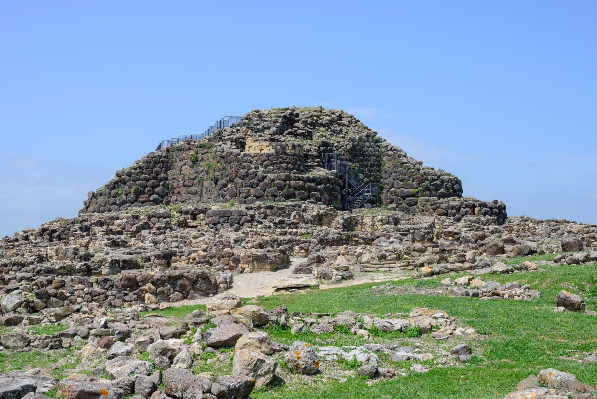
After that, erosion did the work, and it did it unevenly: the marls around the plateau were carried away valley by valley, the basalt was not. The result is a tableland that stands higher than everything around it, not because it rose but because the rest wore down. It is the same stone that Bronze Age builders quarried up here for the towers on the plain below, Su Nuraxi among them.
That slab has another consequence, less visible and more important: it is effectively waterproof. Rain does not sink into it. A thin film of weathered clay settles into the small hollows of the surface and seals the last cracks, so the rain simply stays on top. Each hollow becomes a closed basin — an endorheic basin — with no inflow, no outflow, and no groundwater feeding it from below.
There are not just a handful of them. A study that combined decades of meteorological records with satellite imagery counted more than a hundred pools across those 44 square kilometres, in every size. The larger ones have names local people have used for generations: Pauli Maiori, twenty-three hectares in the territory of Tuili, is the widest; Pauli Majori de susu, in the Genoni sector, covers about twelve; Pauli Oromeo, on the Gesturi side, is around three hectares and about a metre deep at most. The plateau is shared by four municipalities — Gesturi, Genoni, Tuili and Setzu — and the pools are scattered across all four.
The calendar of the water
The cycle is easy to describe and merciless for whatever lives in it. Autumn and winter rain fills the hollows; the water stays until the end of spring; then summer and autumn take it away through evaporation and plant transpiration. Nothing guarantees a minimum level: what comes in is rain, what goes out is air.
The depths are modest. The foundation that manages the plateau gives an average of 30 to 40 centimetres, with maximum depths of 130 to 150 in the biggest hollows; published field surveys of the site report water 30 to 70 centimetres deep. Half a metre of water on a sheet of lava, reflecting the sky for six months of the year.
Walk around and you see the consequence: not all pools live the same life. Standing water lasts longer in the larger pools, so Pauli Maiori still holds water when the small hollows are already mud. Ecologists have a name for how long a pool stays flooded — the hydroperiod — and it is no technicality. It is the stopwatch that decides which organisms manage to be born, grow and reproduce before the dry-out, and which do not.
Measuring that stopwatch across a hundred basins is what a team from the University of Sassari set out to do in 2015, relating the water balance of the whole plateau — rainfall in; evaporation, transpiration, overflow and infiltration out — to the presence and size of the pools, read year by year from freely available satellite images. That is how you work out how far a drier-than-average season shifts the balance, pool by pool.
Two hundred and thirteen algae in seven pools
In 2013 Silvana Alfinito and Mauro Iberite, of Sapienza University in Rome, published the first survey of the algal flora of the paulis. Seven pools sampled, 213 algal taxa identified. Diatoms — the algae with glassy silica walls that look like decorated boxes under a microscope — took the lion's share with 110 taxa, more than half the total. The authors call their work preliminary and ask for someone to carry it further: that count is not a conclusion, it is a first probe into a place nobody had examined at that resolution.
The second survey came from ground level, literally. Between October 2008 and October 2014, returning year after year and month after month, a team of bryologists collected the mosses and liverworts in and around the Giara pools: 56 taxa, fifty mosses and six liverworts. Several of them count as rare or threatened across the Mediterranean.
The same study contains an observation that explains how this environment actually works. Grazing animals walk through the mud of the pond floor, churn it and scuff it; the trampling opens small patches of bare soil, and liverworts of the genus Riccia settle in them. Disturbance, in the right dose, is part of the habitat.
Then there is the vegetation anyone can see, and in spring it is what draws people up to the plateau: the pools fill with a dense white bloom of water crowfoot, the aquatic buttercups of these waters. It lasts a few weeks, it changes the colour of the whole landscape, and it ends when the water drops.
The two crustaceans waiting in the mud
Two crustaceans of the order Notostraca live in the Giara pools: Lepidurus apus lubbocki and Triops cancriformis, both known in English as tadpole shrimps. The first is about twelve millimetres long, with a shield-shaped carapace, an elongated body beneath it and three eyes, two lateral and one in the middle. The second looks much like it and differs in the shape of the rear edge of the carapace. These are the animals popular writing calls living fossils, because their body plan has stayed essentially unchanged for two hundred million years.
The obvious question is how they manage in a pond that stops existing every year. The answer is in the eggs. They lay resting eggs, cysts that survive in dry sediment without water and hatch when flooding returns, even a long time after being laid. This is not an occasional survival trick: it is the reason these animals live in temporary pools and almost never in permanent lakes, where fish would eat them.
In 2021 a review of Sardinia's large branchiopods sorted through a century of records: thirteen taxa for the whole island, eight Anostraca, two Notostraca and three Spinicaudata. For the two Notostraca — that is, Triops and Lepidurus — the only Sardinian sites with recently confirmed occurrence turn out to be the water bodies of the Giara di Gesturi. The wording matters: it does not mean they are extinct elsewhere, it means nobody has found and verified them elsewhere lately. Historically Triops was also recorded in rice fields and lowland pools.
If that confirmation stays the only one, these mud hollows are the last certain address in Sardinia for two animals older than the dinosaurs. Amphibians share the pools with them: the Sardinian tree frog and the green toad.
Habitat 3170*, and why Europe added an asterisk
In the 1992 Habitats Directive, every environment worth protecting has a code. Mediterranean temporary ponds have 3170, with an asterisk beside it: a priority habitat, the category reserved for what Europe is in danger of losing and takes direct responsibility for. The definition reads as if written for places like this one: small amphibious vegetation tied to systems of shallow temporary pools, with most of the life cycle packed between late winter and spring.
The Giara has been part of the Natura 2000 network since September 1995, under the site code ITB041112. The official boundary includes the slopes as well and reaches 6,396 hectares, far more than the tableland itself. Inside that boundary, habitat 3170* is declared over 81.54 hectares: a little over one per cent of the site. Everything described so far — the 213 algae, the 56 mosses, the two tadpole shrimps — lives in that fraction.
Protecting it is not straightforward, because there is no single enemy. The Italian habitat sheet lists intensive grazing among the pressures and, a few lines further down, the abandonment of grazing. They are two sides of one problem: too many animals compact and over-fertilise the pond floor, while no animals at all let vegetation close the hollow until it stops being a pool. The balance that keeps this habitat alive is the one Mediterranean pastoralism built over centuries — and when such a balance breaks, it breaks fast, as happened on the Montiferru massif after the 2021 wildfire.
The other pressure does not show up in a single season. If rain concentrates into fewer days and summers run longer, the hydroperiod shortens, and sooner or later it drops below the time a plant needs to set seed or a crustacean needs to lay eggs. Where that threshold sits, species by species, nobody yet knows. It is the most serious open question about this environment.
The only water on the plateau
There are no rivers on the Giara. For the horses that live up there — a population estimated at between 450 and 600 head, followed since the 1970s by the regional agency AGRIS — the paulis are the only surface water available. While the hollows hold, the horses drink from them; when the hollows go dry, what is left is whatever reaches the troughs.
How thin that margin is became clear on 19 June 2015. A failure in the aqueduct, starting on 10 June, had left the main trough dry at Casa Lavra, in the Genoni sector. The Oristano district office of the regional forestry agency, working within the civil protection system, sent out an IVECO 8017 tanker and carried 2,500 litres in three trips to fill it. One truck, three round trips, and the day was saved.
A popular claim is worth deflating while we are here. The Giara horses are often presented as Europe's last wild horses, direct descendants of animals from the island's Bronze Age. The origin of the population is genuinely uncertain — hypotheses run from prehistoric presence to a Phoenician or Greek introduction — but local sources are clear on one point: until the nineteenth century these horses also lived in other parts of Sardinia, they were owned by local families, branded, and used for threshing grain. This is a feral, closely managed population rather than a relict wild fauna. That makes it a different story, not a lesser one: a story of people, animals, and a rain-filled hollow that decides how many head the plateau can carry.
What to look at while the water is there
Spring is the season, and the reason is everything above: it is the window when the hollows are full and life in and above the water is at its peak. The white bloom on Pauli Maiori lasts only a few weeks and transforms the plateau; in the smaller hollows, where the water is shallower, you can see the green of the bottom straight through the surface.
Three things repay attention on site. The first is the edge: the few metres between open water and dry pasture, where the vegetation changes with every step because the flooding time changes with every step. The second is the churned floor, with its patches of bare soil colonised by mosses. The third, with some patience and decent light, is the shallow water near the bank: tadpole shrimps move in short bursts, digging into the sediment with the front of the carapace, and when they are there you can see them with the naked eye.
Two practical warnings. Walking into the pool does exactly the damage described above, and far more efficiently than a horse does. And the tableland is a Natura 2000 site, so whatever you carry up you carry back down: in a basin with no outlet, anything that ends up in the water stays there until the water evaporates.
Cover photo: Filippo Aroffo, CC BY-SA 4.0, Wikimedia Commons